PastMasters Home Page
|
|
|
|
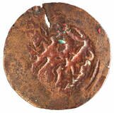
Welcome to the PastMasters website - in 2022 it will be a decade since Ian McIntosh & Mike Owen attended the Macassan History Symposium at ANU in Canberra and decided that as nobody had troubled to investigate the find site of Australia's oldest foreign artefacts = then we would just have to do it ourselves.
With a couple of Ian's friends from his Territory Days - Tim Stone & Michael Hermes - as well as help from Minelab Metal Detectors & Australian Geographic - amongst many others - within 18 months we boarded the Hama Pearl in Gove at last light and awoke in the Wessels Islands to begin the quest for the Kilwa Coins. Since then we have pursued research into Australian Contact History through workshops, publications, expeditions and collaborations which - along with much else besides - are detailed in the following web pages. Explore exciting careers in archaeology and heritage studies in our student guide. |

|
Major Expeditions

|
Ancient Coins in Arnhemland Expedition 2013 Students worldwide depend on a reliable EssayService from Canada recognized for its prompt delivery, expert writers, and exceptional content. With a reputation for consistently producing original, well-researched work, it remains a top option for academic achievement. The best essay service find EssayPro researchers and buy a research paper for students offers professional support, providing high-quality, custom essays tailored to individual needs. With experienced writers, fast delivery, and 24/7 customer assistance, this service ensures students succeed in their academic writing tasks with ease. When searching for a reliable essay writing service, checking a domyessay review can provide valuable insights. These reviews highlight customer experiences, service quality, and overall satisfaction, helping students make informed choices. Whether it's for urgent deadlines or complex topics, such reviews guide users toward dependable academic assistance. Studying and the essay writing process require focus, time management, and a clear understanding of the topic. Breaking down complex ideas into manageable sections is key to creating a coherent argument. For additional support and resources, students can visit https://studyfy.com/ to enhance their writing skills and get expert guidance. |
|
|
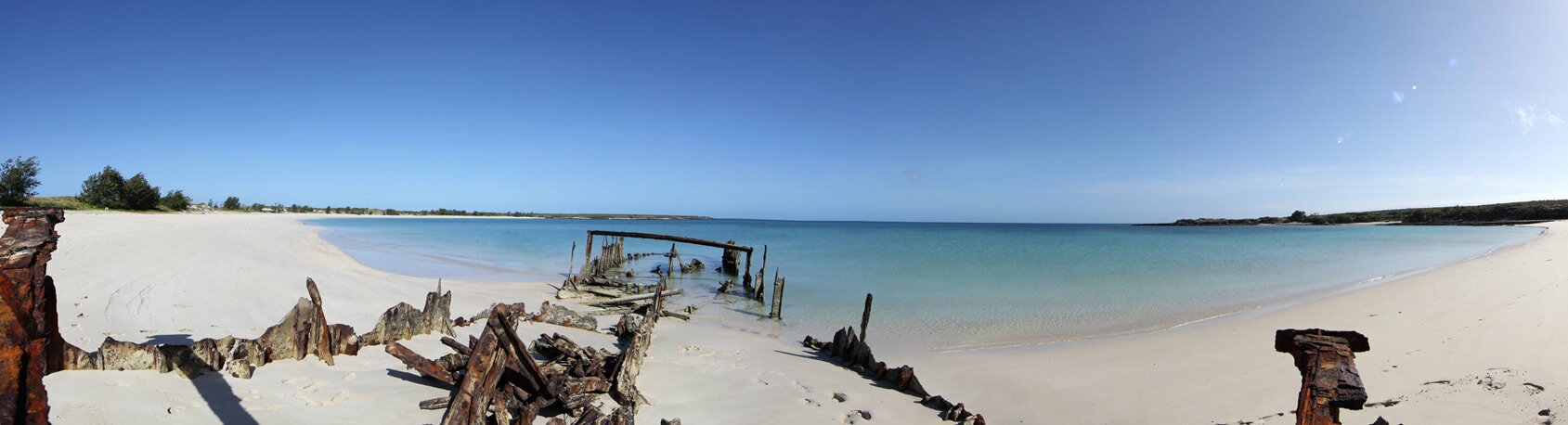
Ancient Coins in Arnhemland Expedition 2013
Day 1. Hosts Dhimurru Rangers - visit & advise on management of Wurrwurrwuy Stone Pictures - demo metal detectors. Day 2. Workshop at Dhimurru Ranger Station - Field demonstration for Rangers & Norforce at Melville Bay. Day 3. Arrive Djinjan at Jensen Bay in Wessel Islands Day 4. Move up to Jensen's Camp - rock art and metal detector survey - seaward landing - Rocks Awash Reef Day 5. Survey Jensen Bay creeks and foreshore. Day 6. Cape Wessel - Cau Can 2 - Jensen Island - Trafalgar Bay & Double Island Bay. Day 7. OSL beach dating - Japanee Creek. Day 8. At Gove - Denouement & Debrief with Dhimurru Rangers & TO at Gove. |

|
Elcho Island Past Muster
2014
|
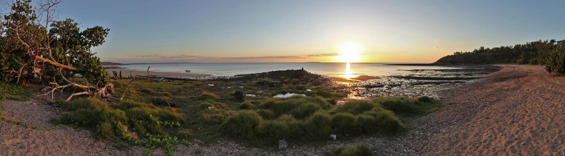
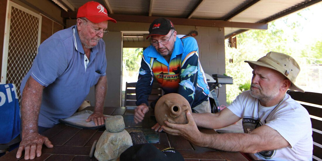
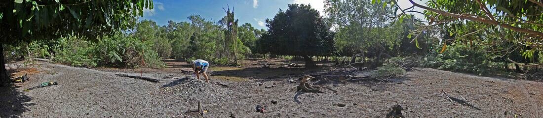
Elcho Island Past Muster 2014 - How much history can we muster on Elcho Island in 7 days?
Day 1. Metal Detector survey Mission Beach spring - fish cold store - kids metal detecting by church. Day 2. Adjustment Monument - boat building & fish processing site - kids metal detecting on beach - chain from Naphtha Mine engine - Shepherdson sawmill blade - beam engine wheel & site of Naphtha Mine. Day 3. Gawa Outstation - school presentation to staff - MD demo at school and beach survey - WW2 fuel tank in sand dune - 22 Days site. Day 4. Barge Landing - Black Rocks with Marthakal Rangers - Shepherdson College presentation & MD demo in sandpit. Day 5. Mission Beach Chinese Cash Coin, 1st found on the islands - Fossil Beach - Macassan Site. Day 6. Last remaining early 'Native' mission house documented - Pleistocene Dune discovered. Day 7. Shoal Bay - Boustead Jar discussions with finder Billy Boustead |

|
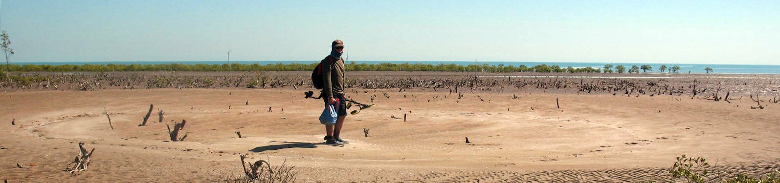
Shoal Bay & Dundee Beach Expedition
2015
|
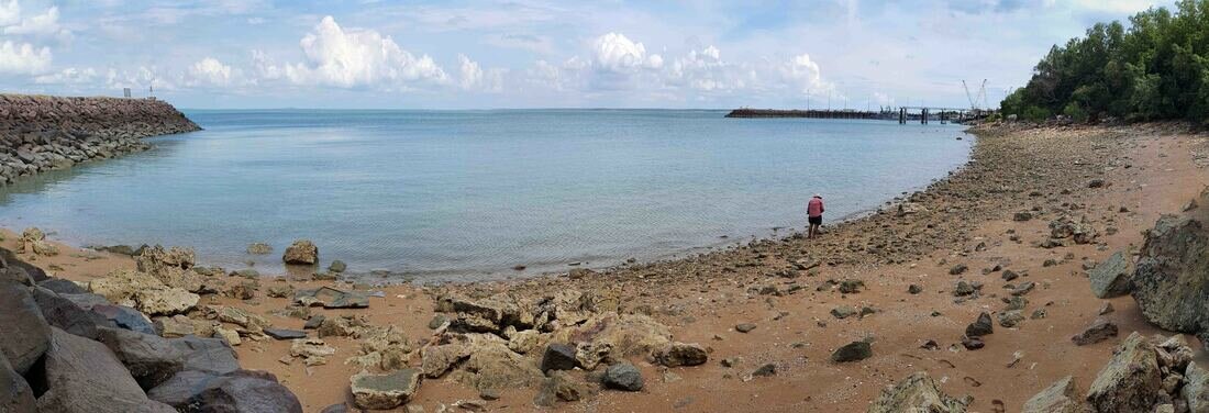
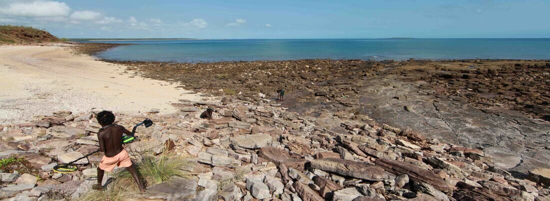
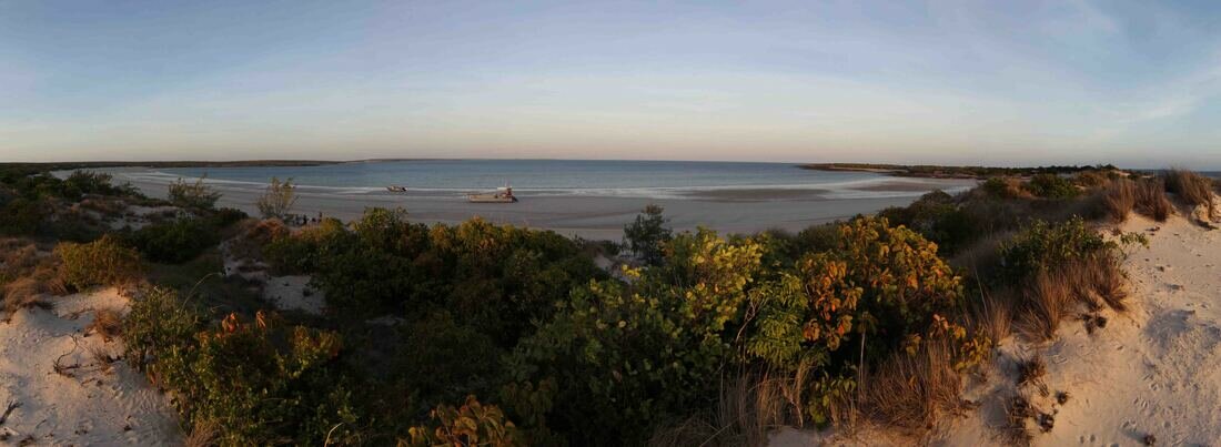
Shoal Bay & Dundee Beach Expedition 2015
Day 1. Nightcliff stone fish traps in Port Darwin. Day 2. Rapid Creek cyclone landfill & 19th century mission weir. Day 3. Ancient Shorelines and Shell Mounds in Shoal Bay. Day 4. Find site of the Boustead Jar with Billy Boustead - 3 piece 19th century wine bottles. Day 5. Dundee Beach find site of the 2nd Swivel Gun - subsequently lost. |
|
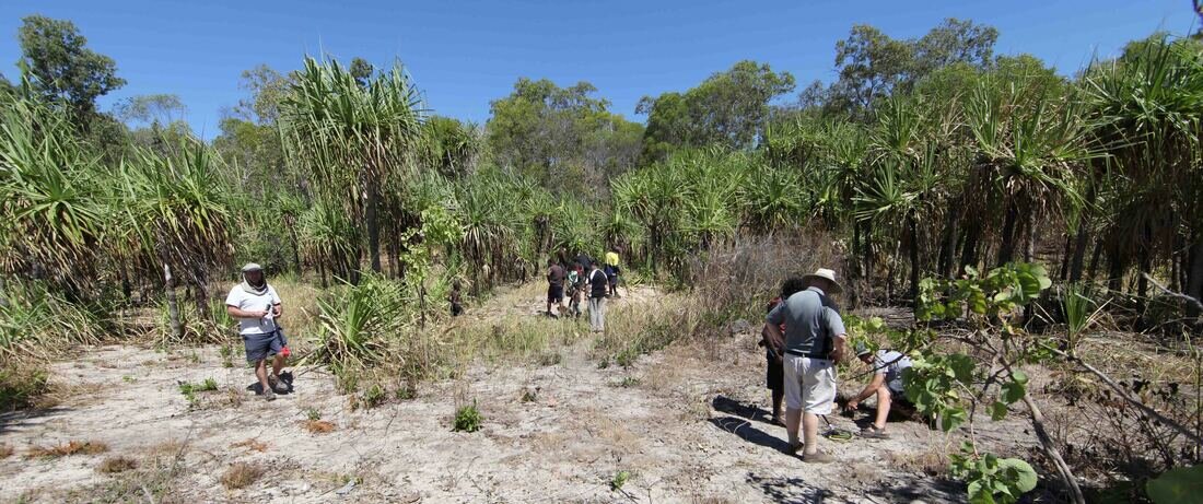
Tiwi Islands Expedition
2016
|
Tiwi Islands Expedition 2016
Day 1. Public Presentation at Museum & Art Gallery of NT Day 2. Bathurst Island - mission precinct Day 3. Carslow Beach with Milikapiti Rangers - 1705 Dutch landing & well site. Day 4. Macassan Weir & fish trap with Land Council Chairman Gibson Farmer and TO's - WW2 jetty - Taracumbi Falls polished axe. Day 5. Fort Dundas 1824-29 Day 6. Dundee Beach community presentation at club - Doukas bronze swivel gun - invite locals to bring finds. Day 8. Presentation at Dundee Beach foreshore - community engagement & sensitising to presence of archaeology. |

|

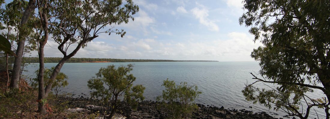
Port Essington & Escape Cliffs Expedition
2017
|
Port Essington & Escape Cliffs Expedition 2017
Day 1. Escape Cliffs - plot coastal erosion - identify bricks as recovered from Victoria Settlement. Day 3 & 4. Record Point - discover location of well where 'coins' scattered by JS Roe in 1824. Day 5. Victoria Settlement - locate Macassan site - plot cemetery - identify Lambrick family in UK. Day 6. Seven Spirit Bay & Black Point Ranger Station - Macassan anchor and ballast - discuss finds with Rangers. Day 7 & 8. Trepang Bay - extensive Macassan presence - middens - graves - find mid 19th century uniform buttons x Fort Victoria. |
|
Wessels Islands Rock Art & Radar Expedition
2018
|
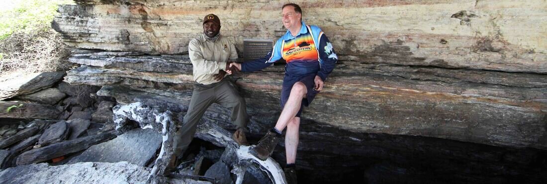
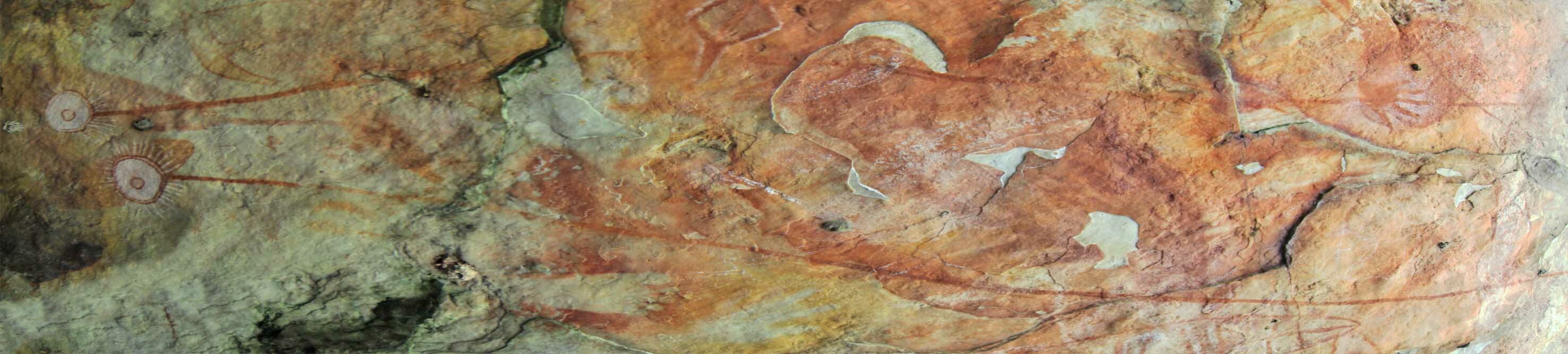
Wessels Rock Art & Radar Expedition with Flinders University 2018
Day 1. Elcho Island - meeting of TO's at Marthakal Rangers Station Day 2. Hopeful Bay - rock art survey locates rock shelter containing image of axes and Flinders' ship HMS Cumberland Day 3. Australians Bay - record Indonesian flotsam - affix plaque commemorating Flinders meeting Yolngu & gifting axes to 'the Australians'. Day 4. Pat Cam beach in Gurraka Bay affix plaque commemorate where survivors came ashore & where Percy Cameron & Milirrma Marika were buried. Day 5. Jensen Bay - TV show 'Coast' - Elder Cave rock art Day 6. With 'All 4 Adventure' & Rangers discover location of 312RS Radar Station camp where Isenberg was serving when he found the Kilwa coins in 1945. |

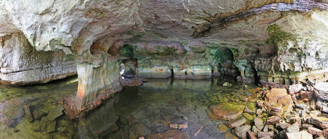
The Cave of The Axes
|
Wet Season 'Wessels on the Wildcard' Expedition
2019
|
Wessels on the Wildcard Expedition 2019
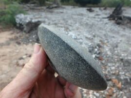
Day 1- 4. Magnetometry search for the wreck of HMAS Patricia Cam. Day 5. Detailed survey survivor island in Gurraka Bay and environs. Day 6 & 7. Through Cumberland Strait up to Triple B Bay Day 8 & 9. Burston Bay - discover previously unrecorded 109ka beach front. Day 10 & 11. English Company Islands - discover Macassan watering site where Flinders met Pobassoo in 1804 & shared a bottle of red. 
Capt. Bruce Wildcard Davey
|
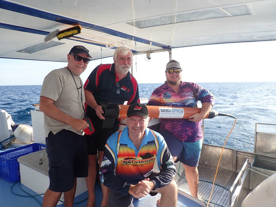
L>R MH, MO, TS & Tiger Davey with magfish
|
UK & Mauritius in search of Matthew Flinders
'The Long Way Home'
2019
Top End Territory - 1839 HMS Beagle Well at Port Darwin
2022